Race to Space
Companies from different sectors are rushing to send satellites into space. Disruption and dynamism are the order of the day. "Space data as a service" is a key market trend that drives verticalization in the industry.
10/2021
How well were the Covid-19 lockdowns in the spring of 2020 actually followed? Views from space provided an answer to this question. Launched in 2017, Europe’s Sentinel 5P Earth observation satellite showed substantial reductions in nitrogen oxide concentrations over major cities like Paris, Madrid, and Rome—corresponding to the slowing down of public life in the EU. Less traffic meant fewer emissions and therefore less air pollution. The precision of the data is little short of miraculous. From an altitude of more than 800 kilometers, Sentinel 5P measures light across a 2,600-kilometer swath of the Earth’s surface in one second. It also measures seven kilometers ahead in the direction of flight, for it moves at a speed of nearly 28,000 km/h—or 7.8 km/s. As it turns out, it has also provided Earth-bound policy makers with information about the effectiveness of their anti-Covid measures.
But artificial satellites are not only useful for analyzing policy decisions. They and their data have become a part of everyday life, with an apparently limitless range of applications. “There wouldn’t be any connectivity on Earth without space,” says Elodie Viau, Director of Telecommunications and Integrated Applications at the European Space Agency (ESA). “There wouldn’t be any navigation, security, or traffic safety systems. Space is the heart of all our connectivity and mobility systems—and the engine for quantum leaps in innovation toward what will become seamlessly integrated, super-intelligent, and high-performance hybrid infrastructures.” Ms. Viau is one of eleven top experts from leading European aviation and aerospace enterprises whom Porsche Consulting queried about the future of the industry in Europe.
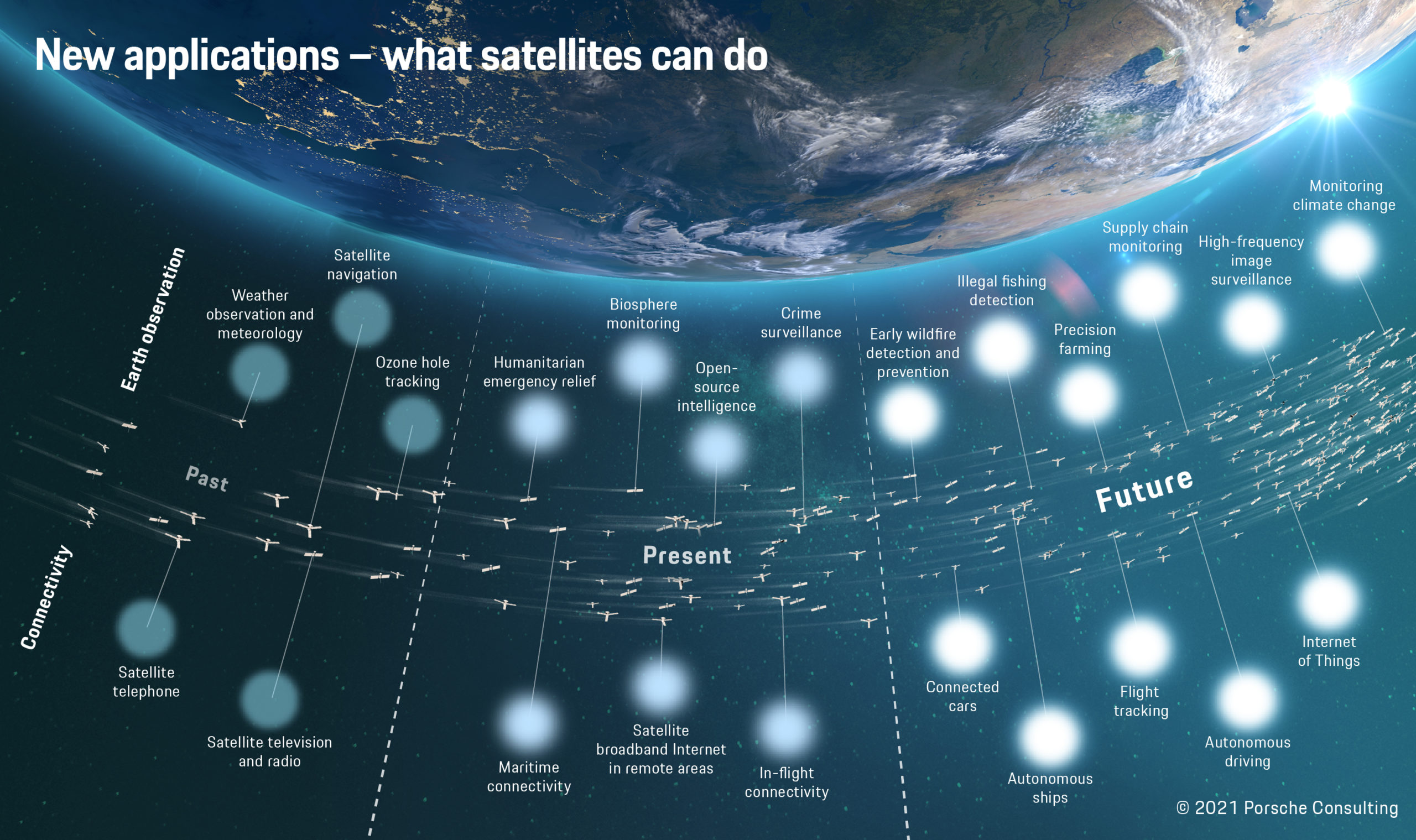
Hunting drugs and tax evaders
New satellites—lightweight and low-priced
Around the world, established companies and start-ups alike are working on new applications and developing innovative business models. “The race to space is underway, with different manufacturers and operators launching ever more satellites every year,” says Joachim Kirsch, Senior Partner for Aviation and Aerospace at Porsche Consulting. That was hardly conceivable until just a few years ago. The satellite business and access to space were considered the realm of governments and their space agencies. But this has changed, for a number of reasons. As Kirsch explains, “Cost-efficient small-scale satellites, some of which have a mass of well under 100 kilograms, are enabling relatively economical access to space.”
They are joined by new launch systems that carry payloads for a fraction of previous costs. “Small launchers—just like small satellites—will become an integral part of the space economy,” predicts Christian Schmierer, Co-CEO of the German start-up HyImpulse, in conversation with Porsche Consulting. “They’ll function like taxis by sending individual satellites quickly, directly, and comparatively cheaply into the desired orbits. That will enable rapid replacement of single satellites in larger constellations.”
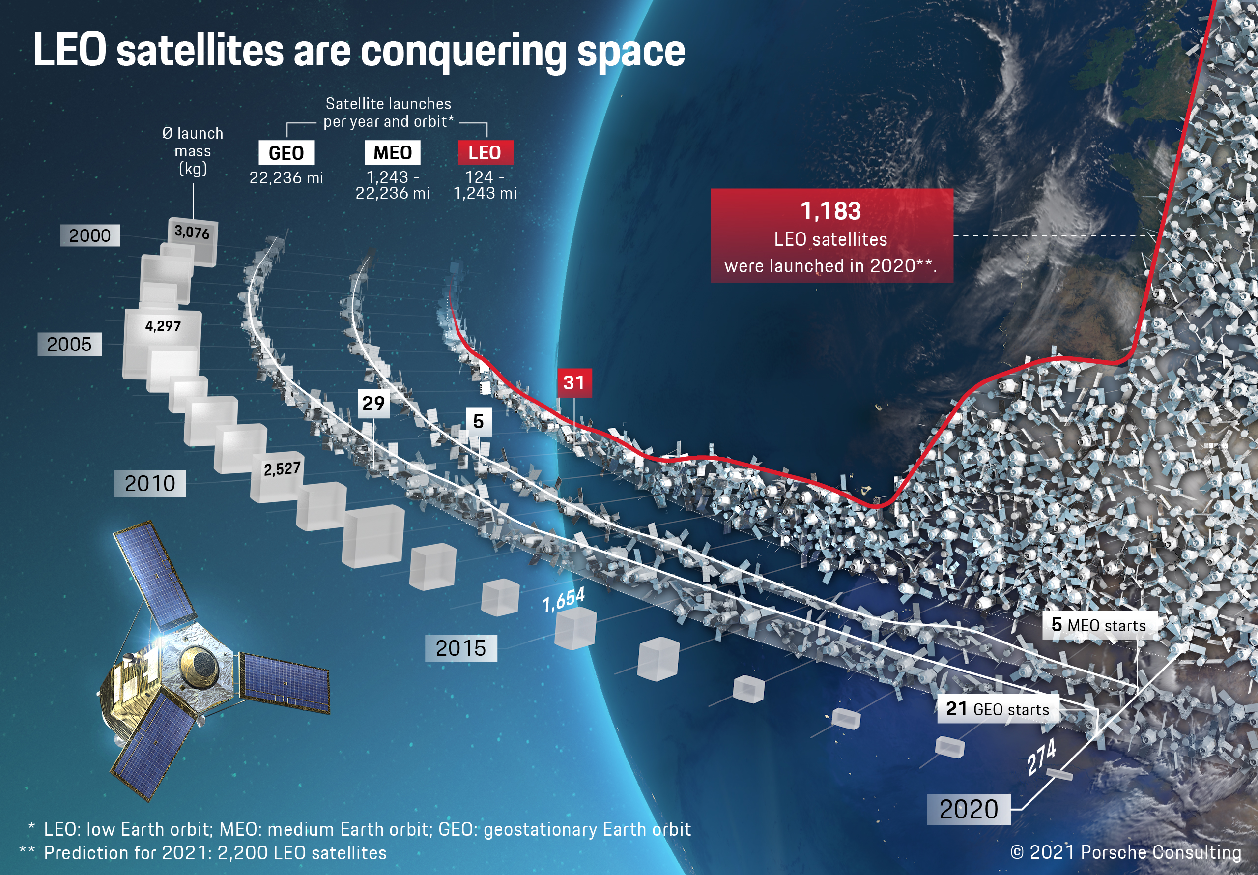
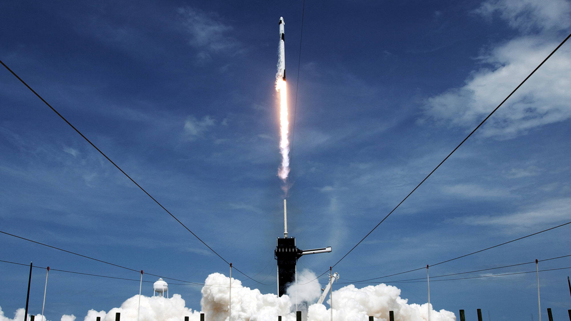
Just one rocket for 60 satellites
Small satellites and launchers have triggered ever greater dynamism and disruption in the industry. Hundreds of start-ups, along with companies from other industries, are crowding into the market and setting up shop in niche areas along the entire value chain with new business models, technologies, and applications. In July 2021 alone, two companies—Astra Space and Planet Labs—were listed on the stock market with values of over a billion dollars. The potential for profit is high, with industry sales expected to reach 1.4 trillion dollars in 2030, up from 400 billion in 2019. Among other things, the newcomers promise an unprecedented pace in moving into space. “Speed and simplicity are key,” says Pierre-Damien Vaujour, CEO of the Loft Orbital Solutions satellite service provider, in conversation with Porsche Consulting. “There will always be projects for very sophisticated end users that run for five years under strict supervision and cost half a billion euros. But there are ever more users in the defense, research, and commercial sectors who view space simply as a source of services and want to be there in nine months.”
Finding and forming successful business models
The most lucrative segment of the satellite market is what is called “space data as a service,” or the sale of data to end customers. “My top megatrend is real-time Earth observation, because it generates content that sets entire value chains into motion instead of simply transporting other people’s data,” says Marco Fuchs, CEO of the northern German aerospace systems provider OHB SE and its subsidiary OHB System AG. OHB’s Digital business unit is active in space data as a service, offering its customers the ability to track ship movements in close to real time, for example, or the latest climate and environmental data.
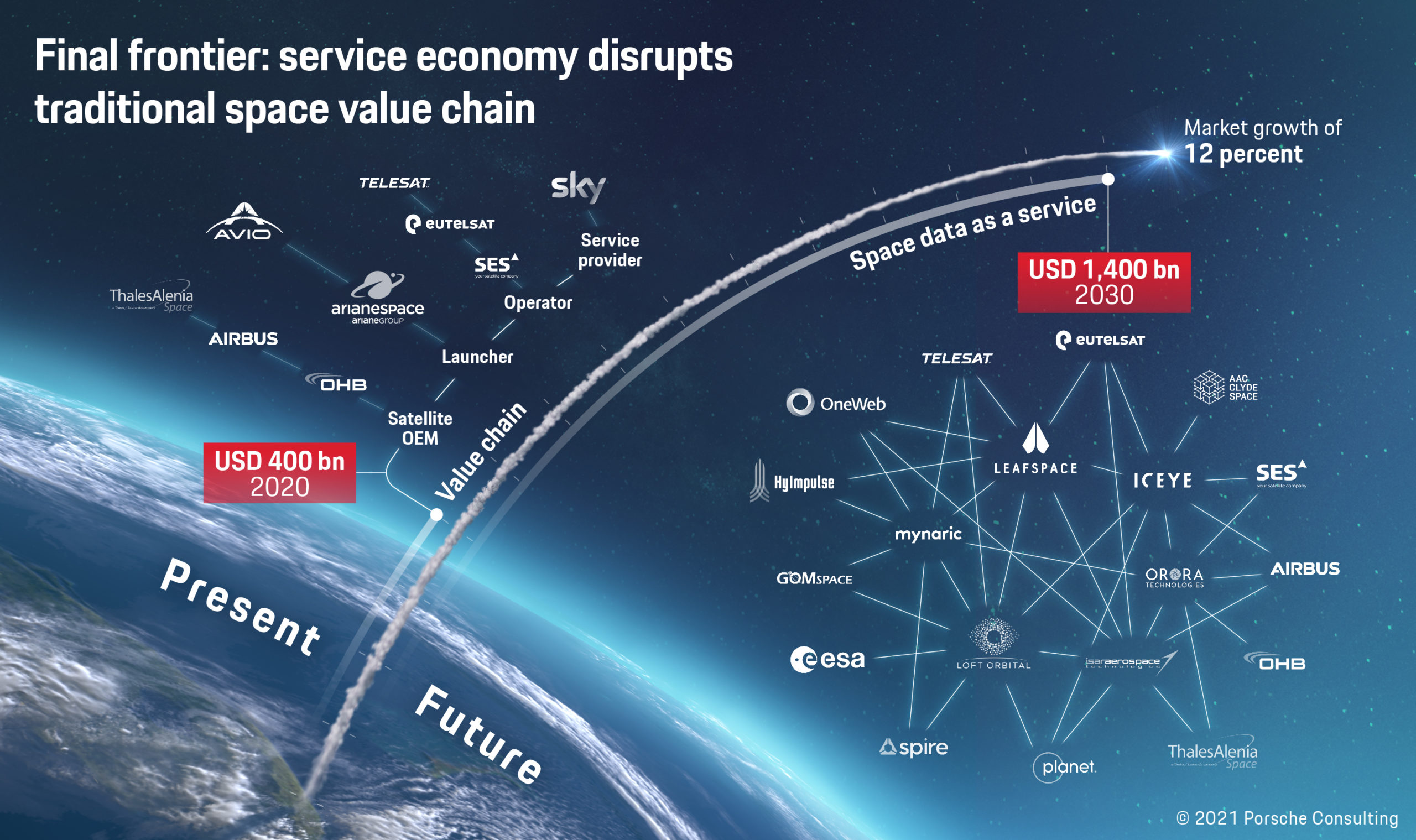
Data mean sales
The breakthrough in the satellite industry is still in its early stages. All players have the chance to position themselves favorably in this growth market. Porsche Consulting has been advising clients for more than ten years in the aviation and aerospace sector, and supporting them in the race to space. Its specialties include choosing the right business models and basic market positioning such as vertical integration along the value chain. Its experts also guide end-to-end industrialization. “On the one hand there are considerably more satellites, yet on the other hand they have to be produced in shorter development cycles and show considerably greater flexibility,” notes Kirsch. “This requires an industrialization process along the entire product life cycle,” he adds, “from product engineering to after-sales services.”
The consultants can also work with space companies to check the economic viability of possible applications for space data as a service, in order to identify promising strategic use cases. Thanks to their broad client base, the experts have a sound grasp of the potential added value of space data in different industries. “It’s crucial not to be misled by hype,” notes Kirsch. “The business model has to be right—that’s the only way to be successful in the race to space.”